1
/
of
1
My Store
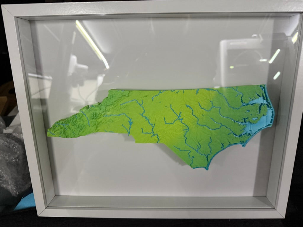
North Carolina State Topographic Elevation Map - Framed Scale with Mountain Ranges and Rivers
North Carolina State Topographic Elevation Map - Framed Scale with Mountain Ranges and Rivers
Regular price
$50.00 USD
Regular price
Sale price
$50.00 USD
Unit price
/
per
All 3D Prints are made to order.
Couldn't load pickup availability
North Carolina State 3D Print, scale accurate with topographical contours. Accurate rivers and elevation features. See mountain ranges, river basins, lakes, hills, valleys, plains all depicted over flowing hues of greens, yellows, and blues.
Makes a great gift for someone who misses home or is proud of where they came from.
Take your shirt off, twist it round your head like a helicopter.
The 14" x 11" Frame has two mounting locations to wall hang.
The actual print of North Carolina is 5" tall by 10" wide.
Share